
Geodetic Survey
What is The Geodetic survey
A geodetic survey determines the precise location of fixed points on the Earth’s surface, taking into account its shape, size, and curvature. Geodetic surveys include consideration of the Earth’s curvature, which allows for greater accuracy in both linear and angular measurements. These surveys cover large areas, and the connections between any two points on the Earth’s surface are calculated as arcs.
To estimate distances projected on plans or maps, adjustments for the curvature of the Earth are applied to the measured distances. The angles formed between curved lines are considered spherical angles. An understanding of spherical trigonometry is essential to making measurements related to geodetic surveying. Geodetic surveying methods are applied when the areas involved or the separations are so large that the required accuracy and precision cannot be achieved by standard or aircraft surveying techniques. Nowadays, geodetic measurements are made using satellites that orbit 12,500 miles above the Earth’s surface.
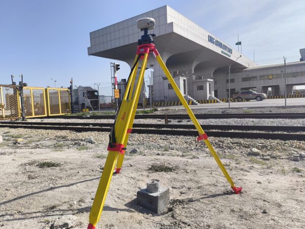
Geodetic Survey
Importance of Establishing a Geodetic Control Survey Network
⇒ For precise assessment of the land required for developing the geodetic plan.
⇒ To execute the staking-out of structures and infrastructure.
⇒ In cases where the information from existing geodetic points is either absent or outdated.
⇒ When the existing geodetic points do not provide adequate data accuracy.
⇒ If the geometry of the existing geodetic network survey does not achieve the necessary measurement precision.
⇒ To conduct control measurements at the time of and after the construction of the facility or infrastructure.
⇒ Networks of geodetic data that are horizontal (also termed positional or benchmark coordinates).
⇒ Networks that deal with altitude (referred to as vertical leveling or benchmark elevation).
⇒ Three-dimensional geodetic networks (which encompass both coordinates and elevation).
Geodetic Survey
Understanding the Scope and Applications of Geodetic Surveying
Geodetic survey are carried out with great precision in order to establish widely distributed control points on the surface of the earth for later aerial surveys. The location of these control points is based on the principle of surveying the entire area rather than the reverse, as previously stated. These surveys require the use of sophisticated instruments and precise methods of analysis and calculation, to ensure accurate locations. To reduce the risk of errors in observations due to aberrations, angular observations are usually limited to nighttime, and arc lamps are used for signaling at survey stations.
This technology is designed to identify and relate the relative positions of objects on Earth, taking into account the size, shape, and gravity of the planet. It is ideally suited for large areas and extended lines, facilitating the precise location of the base points needed to establish control for additional surveys. Geodetic surveying has practical applications such as monitoring Earth movements and accurately defining surface points, which are crucial for satellite tracking and global navigation.
Geodetic Survey
Geodetic Survey Control Establishment and GNSS Processing
Survey Control Establishment: Survey control points serve a variety of purposes and are established for a variety of reasons. In the Kingdom of Saudi Arabia, primary control points have been established by the General Authority for Survey and Geographic Information. These control points are essential because they provide the basic network for all sub-surveys, which must be connected to this primary framework. Additionally, many other survey control points are established for specific projects, including power line construction, road works, and railway projects. Our firm has engaged in a wide range of survey control establishment activities over the years.
GNSS Processing: All GNSS observations must undergo processing to obtain the final coordinates of the control points. The choice of processing strategies and software varies based on the accuracy requirements and the size of the project. Our company uses the latest Leica and Trimble GNSS processing software to ensure the highest accuracy in geodetic processing at the national level. Most of these processing projects are carried out for the General Authority for Surveying and Geographic Information. Additionally, we use Trimble’s Business Center, Micro Survey STARNET, and various other GNSS processing software, depending on the unique needs of each project.
Geodetic Survey
Geodetic Control survey and Spirit Levelling
Geodetic control survey: It is necessary to survey all established control points. The main technique for surveying these control points is through GNSS survey methods. The key difference between survey control points, whether on a national or regional scale, lies in the observation period for collecting GNSS data. Our company offers a range of GNSS instrument models designed for different project sizes. We have a total of 12 geodetic receivers for static surveys at a national or regional level, 8 digital GPS receivers for smaller areas, and 6 RTK GNSS receivers for surveys that require lower accuracy.
Spirit Leveling: Spirit leveling is a technique used to determine the elevation of specific points in relation to a leveling datum. This method is used in geodetic surveying to determine the elevations of basic control points within a geodetic framework, and is also applicable in engineering and construction surveys, such as for the construction of roads, canals, and more. Our company has three digital spirit levels.
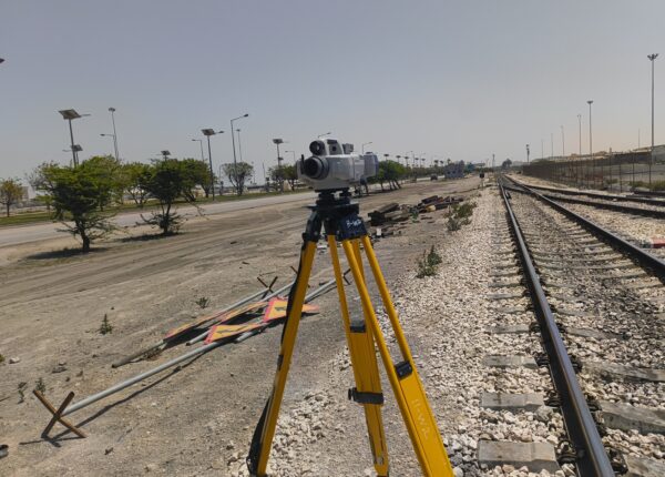
Geodetic Survey Work Process
National Line Survey provide Expert and professional Geodetic Survey in the fields of residential, commercial, infrastructure, and industrial areas.
National Line Survey (NLS) are available according to your Geodetic Survey services requirements at any time in Jubail, Dammam, Khobar, Riyadh, Makkah, Medinah, Jeddah, Yanbu, Jazan, Tabuk, Neom City, and whole Kingdom Saudi Arabia.
Our company (National Line Survey) collect survey data with accuracy and precision to maintain high quality Geodetic Survey services.